Showing posts with label Geography. Show all posts

Saturday, January 21, 2012

South America Map

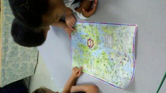
In preparation for the Sixth Age semester-long geography unit on the continents, I made a large-scale map of South America.  When students from each homeroom visit me, they will learn about this part of the world.

I created a flat paper version of South America...


...and cardboard cut outs of each country.


  What a fun learning tool!

Thursday, September 22, 2011

Learning About Maps

6D has been learning about maps in geography. We discussed that a map is a representaion of a region of the earth. It is also a tool that describes the setting of an environment.

We looked for roads, water, and park-like areas on maps together.

In class earlier this week, the students were placed in groups where they located such areas on different maps. They then searched for the map key. A map key is a listing of symbols that tells what each symbol stands for. Some symbols we found on map keys included P for Parking, a fork and knife on top of a dinner plate which represented restaurants, and even a star that stood for a state capital. Nice teamwork, 6D!


Wednesday, January 13, 2010

South America

During the upcoming months in Geography (which began this month- January), each Sixth Age class will rotate among teachers for a continental visit! When students visit me, they will learn about the continent of South America!
This past week 6C went on a taste exploration of South America. We sampled mango juice, which comes from the mango, a sweet fruit widley grown throughout South America; smelled coffee beans and coffee grounds from the country of Columbia; and tried cacao, which is an ingredient used in chocolate production.